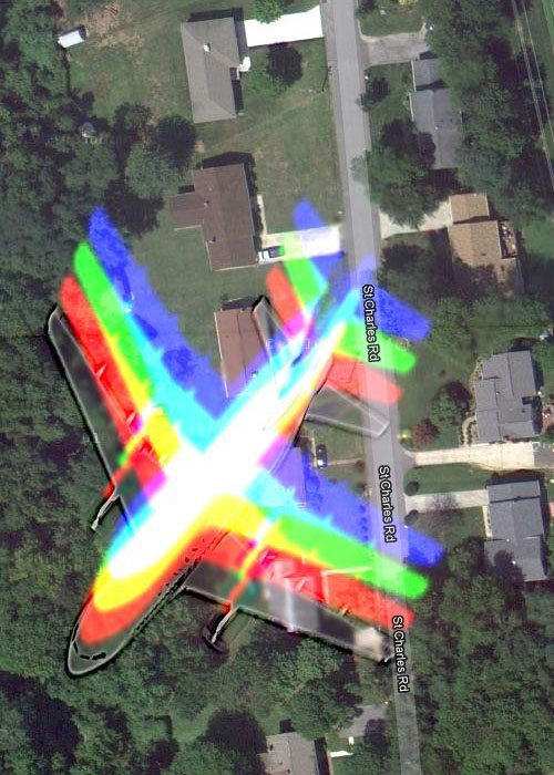
Added 1 new A* page:All kinds of funny things sometimes get in the way of the cameras Google uses for their Google Maps project—ever wonder what happens when an aircraft happens to fly past just as the satellite is taking a photo? IT TURNS INTO A RAINBOW. Or more specifically, an airplane-shaped rainbow. Like here over the Novatec facility near Baltimore, or here outside of Charlotte, or even over Brooklyn, NY.
~~~~
Update 3/22/16: Those maps have all been updated to non-rainbow versions; here's a shot of an old example:
~~~~
According to this page, the colors come from the camera shooting the different color filters in quick succession, rather than all at once. On Twitter this was referred to as a "sequential color frame camera," and there was some speculation on whether the rainbow effect might also show up on particularly fast-moving cars or high-flying unicorns.
|